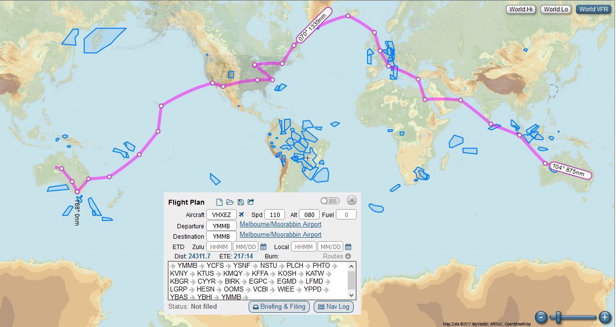
Here’s a first possible route. Going East and I’ve just copied Ryan Campbell’s RTW and added in my home starting and ending point, Morrabbin Airport near Melbourne.
I’ve found some mapping and planning software online called Skyvector. Here’s a screen grab. I don’t think I’ll be doing this route but its a place to start the process.